Routes
For the creation of the routes presented in the project’s augmented reality application for mobile devices, key routes and stops in Athens were selected from the cartographic data and studies on ancient topography of the DIPYLON Company.
With the aim of creating routes in Athens, work focused on defining the project study area and creating content. More specifically, the content creation work focused on the selection of routes and pois (points of interest) in Athens, the development of a methodology for storytelling, the selection of supervisory material and the legal arrangement of the copyright of both the digital application and the individual supervisory material.
Study area
The first step in creating the content of the application was the definition of the study area, within which a thorough survey was carried out in order to select the points of interest. The study area was defined as the historic centre of Athens, i.e. the area of the city that falls within the ancient walls. The boundaries of the project cover both the important archaeological sites of the city, scattered monuments that have been integrated into the modern urban fabric, and obscure antiquities that, over the years, have been urban landmarks that have shaped the identity of the city.
Choice of routes and stops
The first step in route selection was to identify the excavation sites within the project study area. At this stage, the addresses of the city’s salvage excavations were compiled. In this way, the densities of sites of archaeological interest within the modern urban fabric were mapped. The second step was the structuring of an ontological methodological scheme that allowed us to set the thematic and spatial criteria of the stops (pois).
Thematic approach – qualitative and quantitative evaluation of published archaeological data
Regarding the thematic criteria, we collected and studied all the published archaeological remains that fall within the thematic typologies of the application (the trade routes, the city’s defences and the places of worship) in order to qualitatively and quantitatively evaluate the archaeological data and their dispersion in the study area. At this stage, excavated data were extensively researched and then selected those that: a) remain accessible, b) provide sufficient abundant published survey material for the development of augmented reality technology, and c) are also suitable for creating narratives that can cover the historical palimpsest of the city.
Spatial approach – assessment of the contemporary urban landscape
Regarding the spatial criteria, we studied the connectivity of the archaeological data in the urban fabric in terms of distances and walking time. We focused on the spatial connectivity of data of common and different typologies. In order to ensure the most user-friendly routes, we examined the spatial configuration of the study area through the analysis of its syntactic pattern (space syntax). Our aim was to evaluate the accessibility of the points of interest (pois) that make up the study area. In this way, we excluded parts of the area that are less accessible and navigationally friendly.
The neighborhoods were selected to be studied after analyzing the syntactic pattern of the area. (The road network axes are coloured according to the integration value they receive, colour gradation: red high values – blue lower values. Integration is a measure that shows in simple terms how accessible specific road sections are for pedestrian traffic in the area.)
Route definition – choice of stop densities (pois)
The continuous occupation of the city since ancient times gives the site successive layers of human activity and provides the researcher with a wealth of archaeological and historical data. In order to determine the application paths, we studied the above data extensively by drawing information from all relevant publications (excavation reports, relevant literature) and then collected the relevant survey material. The published excavation reports of the Archaeological Bulletin were extremely helpful for this work. Our goal was to create point densities (pois) in which the user could search all typologies offered by the application, in order to highlight and maximize the potential for a personalized experience to the user.
Content collection of stops (pois)
The content of the stops aims to wander through the narrative in the different layers of the city (ancient, modern, contemporary) in order to constitute an experiential cognitive and educational journey through the history of the city and to enable visitors to navigate a wide historical spectrum.
The archaeological data used in the project come from the results of excavations carried out from the early 20th century to 2012 and are published in the volumes of the Archaeological Bulletin (AD), the Proceedings of the Archaeological Society (PAE), the Bulletin of the Christian Archaeological Society (CSA) and in relevant printed and online literature from collective volumes and monographs. Indicatively, some sources that constitute a milestone in the research of Athenian topography are mentioned:
- Travlos, J. (1960). Urban development of Athens. From prehistoric times to the beginning of the 19th century. Athens.
- Travlos, J. (1971). Pictorial Dictionary of Ancient Athens (London). Treu, M. (1967), review of Bowra (1964). Gymnasium, 74, 149-53.
- Papachatzis, N. (1994). Attica, Volume 1, Athens.
- Camp, J. M. (2009). The Antiquities of Athens and Attica. Athens: Institute of the Book-Cardamitsa.
- Bouras, C. (2010). Byzantine Athens: 10th-12th century, Benaki Museum.
- Georgopoulou, M. (2019). Ottoman Athens: Archaeology, Topography, History.
- Kambouroglou, D. G. (1890). Monuments of the history of the Athenians.
- Kambouroglou, D. G. (1969). History of the Athenians (Ottoman period 1456-1687) vol. Oikos “Palmos” N. Antonopoulos & Co.
- Biris, K. (1966). Athens from the 19th to the 20th century. Athens: Melissa.
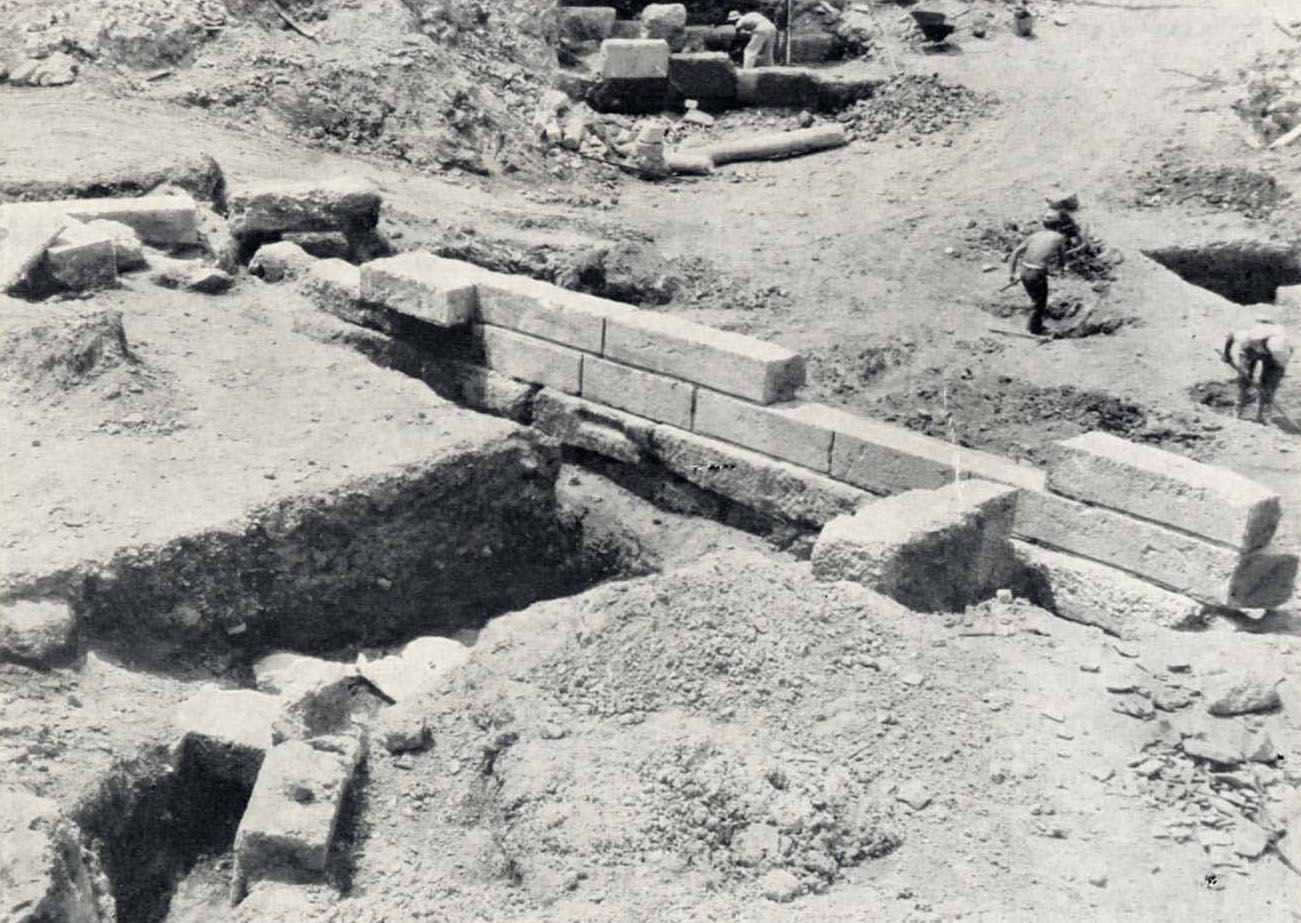
The supervisory material collected for the needs of the project includes published documents on the history of the city, such as historical maps, illustrative material of travel publications from the 15th to the early 19th century, excavation snapshots and rare photographs of Athens of the 19th and 20th century from private archives, digitized libraries and published albums. Access to the aforementioned documents is incomplete and their use has been registered by permission of the competent authorities. By way of example, some digitised collections from which the supervisory material has been extracted are listed:
- Digitized Collections of the Hellenic Literary and Historical Archive (ELIA).
- Benaki Museum Library.
- Library of the Aikaterini Laskaridis Foundation.
- Hellenic Library – Alexander S. Onassis Public Benefit Foundation.
- German Archaeological Institute.
- American School of Classical Studies in Athens: Gennadius Library – American School of Classical Studies in Athens.
- American School of Classical Studies in Athens: The American Academy of Greek Studies at the Athens University of Athens, Athens, Greece.
- Historical and Ethnological Society of Greece
- Photographic Archive of the Jewish Museum of Greece.
- Photographic Archive of the Greek Jewish Museum of Greece.
- Photographic Collection of the National Library of France (BnF)
In the context of the project, for the creation of a “Virtual Street Museum” through which visible and non-visible elements of ancient topography will be highlighted on the canvas of the modern city, transforming the street as a museum, three main thematic units were chosen: the trade routes, the city’s defence and places of worship.
Places of worship
The role of places of worship is central to understanding the lives of people over time. And Athens lends itself to a walk through such memories that have remained alive in the body of the capital because of the multitude of shrines of each religion that surprise the walker. The choice of stops focused on lesser known sites, such as the ancient sanctuary of Artemis Agrotera on the Ilisos, the Byzantine temple of the Holy Asomatos at Skalia in the propylon of the Library of Hadrian, as well as Christian temples with a special tradition, such as the temple of Agia Fotini in Ardittos Street, and St. Philip of Hadrian’s Street, the place where, according to tradition, the Apostle Philip spoke to the Athenians. The sanctuaries of Ottoman Athens also enrich the visitor’s experience through the narratives that accompany the monuments, mainly from 18th and 19th century travel accounts.
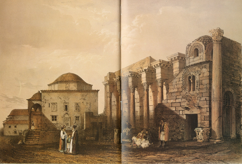
Snapshot in front of the Library of Hadrian and the Church of the Holy Asomaton, as captured by the traveller Théodore Du Moncel in 1843. Source: DU MONCEL, Théodore. Excursion from Athens to Nafplio in 1843, Athens, Olkos-Ariadni, 1984, from the website www.travelogues.gr from Aikaterini Laskaridis Foundation.
The theme of worship makes it easier for the user to understand the multiculturalism of Athens throughout the centuries. Ancient altars and shrines give way to large early Christian churches and small chapels, Byzantine metochia and Islamic mosques and shrines established next to post-Byzantine churches in Ottoman times. The narratives of worship are not approached strictly through architecture and temple architecture, but highlight deeper concepts such as those of public space, the coexistence of different religions and the importance of places of worship in Athenian neighbourhoods and in the everyday life of residents over time.
Defence of the city
The remains of the fortification stand out today as a reminder of a huge public work of antiquity, which is indicated by their massive construction, the large area they occupied in space, and their solid and durable structure. Thanks to archaeological research, we know that the walls ‘followed’ the great events of the city as closely as few monuments. In this context, a walk through the now visible remains of the ancient walls in underground and open spaces in the centre of Athens is proposed, highlighting both the monumentality of the ancient fortification and its integration into the recent history of the modern city.
The theme of defence proposes the understanding of a great archaeological ensemble, such as the fortified enclosure, through a new prism, that of public architecture. Walls were a component of ancient Greek cities. In times of peace, the course of the wall defined the boundaries of the cities, while the gates marked the main channels of communication in times of war, offering security from enemy attacks and at the same time symbolizing the power of the city. The walls were a mirror of the prosperity and extent of the city. Throughout the long history of Athens, the course of the walls has changed many times, signifying the different historical chapters of the city. Finally, the concept of the monument within the city and outside the enclosed archaeological sites reinforces the perception of modern Athens as an open street museum.
Scenes of the city
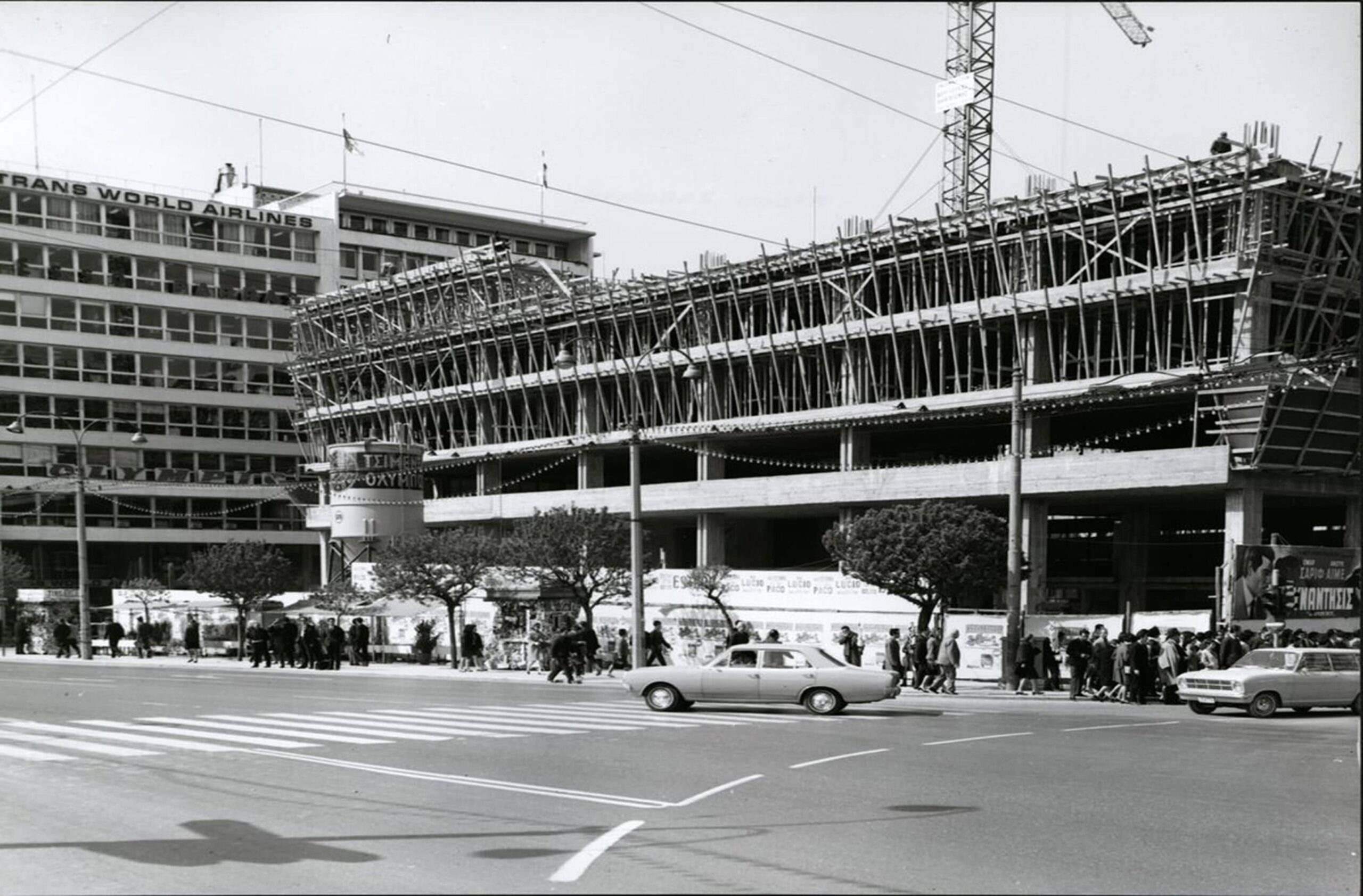
Scenes of the City are images of fragmentary memory as well as representations of life in the city from the late 19th century to the modern era. These images are evidence of the historical, economic, political, social and cultural processes that shaped the contemporary image of the city. This evidence was drawn from photographic archives of public institutions, family archives of Athenian merchants, the media, literature and popular Greek cinema of the sixties. The selected sites converse with the sites of archaeological interest highlighted in the other categories, building a symbolic bridge and a spatial connection to the present. Among other things, the changes occurring in the urban environment, the creation of the first infrastructures or the phases of the tourist development and operation of the historic centre are reflected. It also highlights the historical development and transformation of historic landmarks in the city, such as the building of the Ministry of Finance in Syntagma. This category contributes to highlighting the historical development of the city and complements the digital street museum of Athens with attractive content for the user of the application.


